GASHERBRUM II EXPEDITION 2027 (8,035M)

Rising to an impressive altitude of 8,035 metres, Gasherbrum II (G2) is the world's thirteenth-highest mountain and one of the most sought-after objectives in high-altitude mountaineering. Situated in the magnificent Gasherbrum Massif, along the Pakistan–China border, this remarkable peak stands among the legendary fourteen 8,000-metre mountains of the world.

Book NowView Itinerary

GASHERBRUM II EXPEDITION 2027 (8,035M)GASHERBRUM II EXPEDITION 2027 (8,035M)GASHERBRUM II EXPEDITION 2027 (8,035M)GASHERBRUM II EXPEDITION 2027 (8,035M)
Book Now

Conquer Gasherbrum II – An Extraordinary Karakoram Mountaineering Challenge

Rising to an impressive altitude of 8,035 metres, Gasherbrum II (G2) is the world’s thirteenth-highest mountain and one of the most sought-after objectives in high-altitude mountaineering. Situated in the magnificent Gasherbrum Massif, along the Pakistan–China border, this remarkable peak stands among the legendary fourteen 8,000-metre mountains of the world.

Known by its survey designation, K4, Gasherbrum II was identified in 1856 by British surveyor Thomas George Montgomerie during the Great Trigonometrical Survey of India. Its traditional Balti name carries a particularly beautiful meaning. Derived from the words Rgasha, meaning beautiful, and Brum, meaning mountain, Gasherbrum reflects the extraordinary natural beauty of the Karakoram.

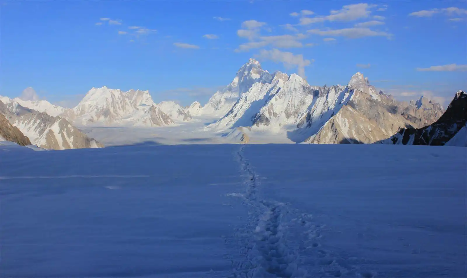
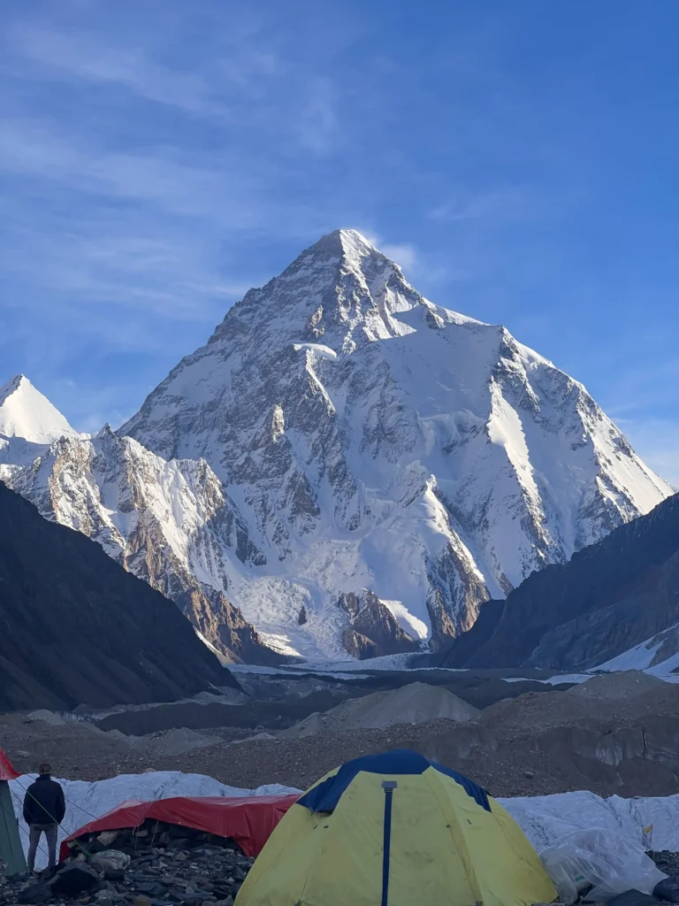
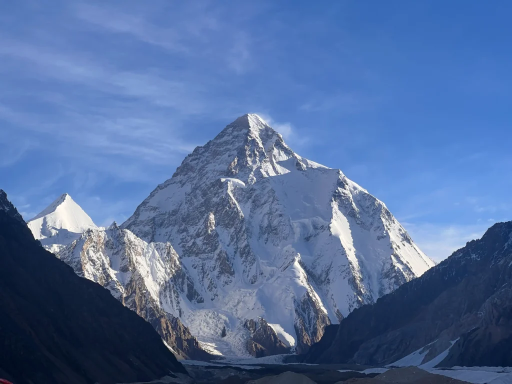
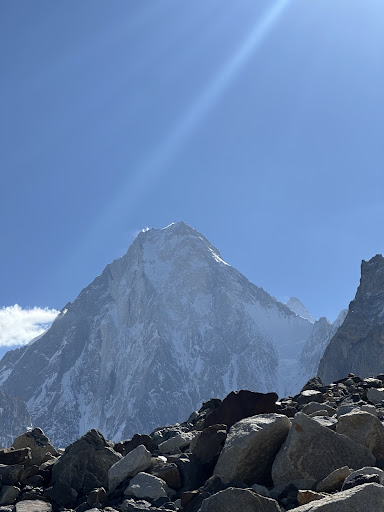
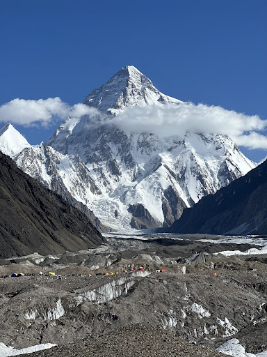
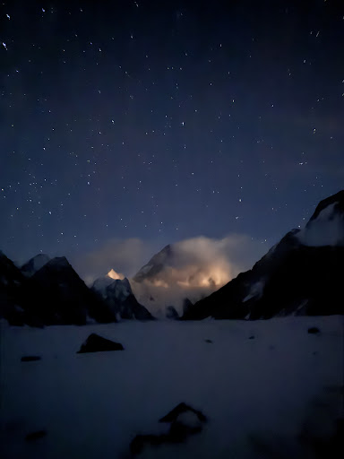
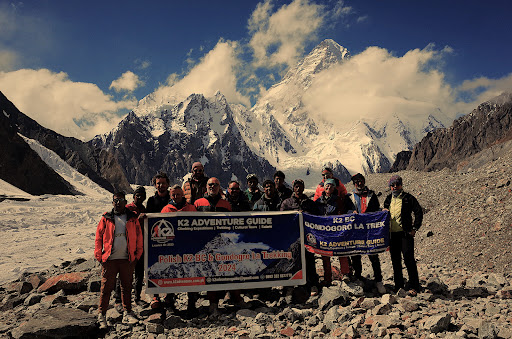
The Gasherbrum II Expedition 2027 presents an exceptional opportunity to explore this remote mountain environment and attempt one of the world’s great Himalayan-Karakoram summits. Its spectacular surroundings include the vast Baltoro Glacier, the impressive Muztagh Tower, Masherbrum, Broad Peak, Gasherbrum IV and the legendary K2.

GASHERBRUM II EXPEDITION 2027 (8,035M)GASHERBRUM II EXPEDITION 2027 (8,035M) trail

8,035 mPakistan

A Mountain with a Remarkable Climbing History

The Gasherbrum Massif first received considerable international attention in 1934, when a Swiss-led expedition under Günter Oskar Dyhrenfurth explored its surrounding glaciers and peaks. Although the expedition did not achieve either of the Gasherbrum summits, it played an important role in opening the region to future mountaineering attempts.

The first successful ascent of Gasherbrum II was accomplished on 7 July 1956 by Austrian climbers Fritz Moravec, Josef Larch and Hans Willenpart. Their expedition faced considerable difficulties, including an avalanche and serious shortages of food supplies. Despite these setbacks, the three climbers successfully reached the summit, establishing an important milestone in Karakoram mountaineering history.

Another extraordinary achievement came in February 2011, when Simone Moro, Denis Urubko and Cory Richards completed the first winter ascent of Gasherbrum II. Their success, achieved without supplementary oxygen or high-altitude porter support, demonstrated the remarkable determination and technical ability required for winter climbing in the Karakoram.

Why Choose Gasherbrum II?

Among the fourteen 8,000-metre peaks, Gasherbrum II is often regarded as one of the more accessible mountains in terms of its standard climbing route. This reputation has made it an attractive objective for experienced mountaineers seeking their first or another 8,000-metre summit.

However, its relatively favourable reputation should never be confused with an easy ascent. Climbers must overcome extreme altitude, crevassed glaciers, steep snow slopes, changing weather and the physical demands of prolonged exposure above 8,000 metres.

Gasherbrum II has also attracted adventurous mountaineers interested in ski descents and other specialised high-altitude activities. Its remarkable climbing history continues to inspire expeditions from around the world.

For those aiming to reach an 8,000-metre summit, G2 offers an exceptional combination of mountaineering challenge, spectacular scenery and historical significance.

Best Time to Climb Gasherbrum II in 2027

The principal climbing season for Gasherbrum II is during the summer months, particularly July and August. These months generally provide the most suitable conditions for establishing higher camps, acclimatising and planning summit attempts.

Weather conditions in the Karakoram can change rapidly, even during the main climbing season. Strong winds, heavy snowfall, low temperatures and unstable conditions can affect expedition schedules and summit opportunities.

A successful ascent therefore depends on careful acclimatisation, appropriate expedition planning, experienced high-altitude support and a suitable weather window.

Gasherbrum II Expedition 2027 – Your Next 8,000-Metre Achievement

The journey towards Gasherbrum II is much more than a summit attempt. It is an opportunity to experience the extraordinary landscapes of the Karakoram, travel across some of the world’s most impressive glaciers and challenge yourself in one of the planet’s most demanding mountain environments.

K2 Adventure Guide provides expedition support for climbers undertaking this remarkable journey, with a focus on local expertise, logistical coordination and high-altitude expedition services.

Join our Gasherbrum II Expedition 2027 and take on the challenge of standing on the summit of one of the world’s legendary 8,000-metre mountains.

Discover the Shigar and Braldu Valleys

The journey to K2 Base Camp begins in Skardu, the gateway to the mighty Karakoram mountain range. From here, trekkers travel north into the spectacular Shigar Valley, a region celebrated for its fertile landscapes, traditional Balti settlements, ancient cultural heritage, and extraordinary mountain scenery.

The Shigar River flows southward to meet the Indus River near Skardu. Its waters originate from the confluence of two important mountain rivers: the Braldu River, which drains the Baltoro Glacier region, and the Basha River, fed by glaciers including Chogo Lungma.

The Braldu Valley is particularly important in the history of Karakoram exploration. For generations, it has provided access to some of the world’s most famous mountaineering destinations, including K2, Broad Peak, the Gasherbrum peaks, Concordia, and the Baltoro Glacier.

The valley also connects with the Biafo Glacier, an important gateway to Snow Lake, Hispar Pass, and the historic glacier crossing toward Hunza.

Shigar – A Historic Kingdom of Baltistan

Before entering the remote Braldu Valley, the journey passes through Shigar, once the capital of an independent Himalayan kingdom.

Shigar is renowned for its traditional architecture, historic wooden houses, ancient mosques, and royal heritage. Its old buildings demonstrate the exceptional craftsmanship of Balti and Kashmiri artisans.

One of the area’s most remarkable architectural traditions is the construction of wooden mosques featuring elaborately carved pillars, decorative balconies, and tiered roofs.

These structures reflect centuries of cultural exchange between Baltistan, Kashmir, Tibet, and the wider Karakoram region.

The Historic Road to Askole

From Shigar, the route follows the Braldu River deeper into the mountains.

Historically, the road to Askole was a difficult jeep journey, often interrupted by landslides, river crossings, and unstable mountain slopes. Early explorers depended on local drivers, porters, and villagers to navigate this remote landscape.

The historic route passed settlements such as Dassu, Apaligon, and Hoto before continuing toward the upper Braldu Valley.

At Apaligon, the Braldu River narrows dramatically between steep rock walls, creating one of the valley’s striking natural features.

The old trekking approach also passed the villages of Chongo, Tongol, and Surungo, where cultivated terraces and traditional settlements contrasted with the surrounding barren mountains.

Modern road improvements have made Askole more accessible, although weather, landslides, and road conditions can still affect travel.

Chongo Village and the Legend of King Kiser

The area around Chongo contains fascinating traces of Balti folklore.

According to the historical account, hot sulphur springs near the village were associated with the legendary King Kiser, a heroic figure in traditional stories of Baltistan and neighbouring mountain regions.

The surrounding copper-coloured rocks were known locally as Lompo Kiser, or Kiser’s Fort.

Local legends describe King Kiser’s adventures, battles, and encounters with supernatural beings. These stories form part of the oral heritage of the region and offer a fascinating glimpse into the traditional beliefs of mountain communities.

The historical route also offered views of Mango Gusor (6,288 m) and the pyramid-shaped Bakhor Das Mountain (5,809 m).

Askole, also written Askoli or Askoley in historical travel literature, is one of the most important settlements in the history of Karakoram mountaineering.

Located at approximately 3,000 metres above sea level, the village has traditionally served as the final permanent settlement before the long journey toward the Baltoro Glacier, Concordia, and K2 Base Camp.

For more than a century, Askole has welcomed explorers, surveyors, scientists, climbers, and trekkers travelling into the heart of the Karakoram.

The Origins of Askole Village

According to the historical account in the uploaded book, Askole was founded approximately 500 years before the author’s visit.

Local tradition tells of a prince from Nagar who crossed the Hispar Pass after fleeing a conflict with his brother. He discovered fertile land in the Askole Valley, married a Balti woman from Shigar, and established a settlement.

This story reflects the historic connections between Baltistan and Nagar through the high mountain passes of the Karakoram.

Askole and the Ancient Trade Routes

Before modern trekking and mountaineering developed, Askole was connected to ancient trade routes crossing the Karakoram.

Until approximately the middle of the eighteenth century, routes through the Mustagh passes helped connect Baltistan with regions north of the mountains, including areas of present-day Xinjiang.

Changing glacier conditions eventually made some of these routes increasingly difficult or impassable, contributing to the decline of traditional trade.

The history of Askole is therefore closely linked not only to mountaineering but also to centuries of migration, trade, and cultural exchange.

Traditional Balti Houses and Village Life

The historical description portrays Askole as a compact settlement of approximately 40 houses surrounded by terraced agricultural land.

Traditional houses were constructed using local stone, wood, and other available materials, with narrow passageways connecting the buildings.

Families adapted their homes to the harsh mountain climate. Summer living areas, rooftop sleeping spaces, and sheltered winter rooms were part of the traditional architectural design.

Agriculture and livestock formed the foundation of village life. Families cultivated cereals, vegetables, and fruit while maintaining herds of sheep, goats, yaks, and other animals.

Seasonal movement between villages and mountain pastures was an important part of the local economy.

These descriptions provide a valuable historical picture of Askole, although the village and its infrastructure have changed considerably since the book was published.

The People and Culture of Askole

The people of Askole speak Balti, a language with deep historical connections to the Tibetan linguistic family.

Traditional clothing, village architecture, local food, and oral storytelling preserve important aspects of Baltistan’s cultural identity.

The historical account also describes distinctive women’s clothing, including long traditional garments, decorated cuffs, colourful belts, and ornaments.

Today, Askole remains closely connected to the mountaineering industry. Many local families have generations of experience working as guides, porters, cooks, and expedition support staff.

Their knowledge of the terrain, weather, river crossings, and mountain conditions has contributed to countless successful expeditions.

The Historic Skoro Pass Route

Another fascinating feature of the region is the old mountain route connecting the Shigar area with Askole across Skoro Pass, approximately 5,073 metres above sea level.

The historical guide describes a three- to four-day crossing from Skoro toward Askole, including steep glacier sections requiring appropriate mountaineering equipment.

This route was also associated with the historic Skardu Marathon, a demanding mountain event described in the book.

Unlike the standard road approach used by most modern K2 Base Camp trekking groups, Skoro Pass represents an adventurous alternative requiring separate planning, suitable conditions, and technical experience.

Itinerary

  • Altitude: 540 meters
  • Trekking Time: N/A
  • Weather: Warm and humid; Avg High: 35°C / 95°F, Low: 24°C / 76°F

Details:

Welcome to Pakistan! When you arrive at Islamabad International Airport, our representative will meet you and transport you to your accommodation. Depending on when you arrive, you may have time to tour the city. Islamabad is one of the world’s greenest capitals, and we can arrange cultural orientation tours to the Faisal Mosque, the Daman-e-Koh viewpoint, and Saidpur village. Later in the afternoon or evening, your guide will provide a full trek briefing on safety, route, gear check and expectations for the adventure ahead.

  • Altitude: 2,230 meters
  • Trekking Time: N/A
  • Weather: Pleasant; Avg High: 23°C / 73°F

Details:

On a clear day, an early morning scenic flight over the Himalayan and Karakoram ranges would offer breathtaking aerial views of Nanga Parbat, Rakaposhi, and probably even K2. Once you arrive in Skardu, you will be taken to your accommodation. The rest of the day is spent relaxing and exploring. You may wander through Skardu Bazaar, see Kharpocho Fort (an optional short trek), or walk along the banks of the magnificent Indus River. It’s also an excellent day to do any final purchasing for personal items or trekking snacks.

Note: In case of flight cancellation due to weather, a backup overland drive via Karakoram Highway (2 days) will be arranged.

  • Altitude: 2,230 meters
  • Trekking Time: N/A

Details:

We spend a relaxing day in Skardu to help us acclimatise. You can take a short trip to Satpara Lake, visit the stunning Shigar Fort—a 400-year-old fortress converted into a heritage hotel—or simply relax and breathe in the mountain air. This is also the day that we manage trekking permits, finalise logistics with porters, and prepare for departure. Our experts will double-check your equipment and assist with any last-minute changes.

Altitude: Approximately 3,000 m
Travel: Approximately 6–8 hours by jeep, depending on road conditions
Accommodation: Camping

Our adventure begins with a scenic jeep journey from Skardu into the beautiful Shigar Valley. The road follows the mighty Indus River before entering the historic Shigar region, once an independent mountain kingdom known for its traditional Balti architecture and cultural heritage.

Continuing north, we travel alongside the Braldu River, whose waters originate from the vast glaciers of the Karakoram. The journey passes through rugged mountain landscapes and settlements such as Dassu, Apaligon, and Hoto before reaching Askoli.

Askoli is the last major traditional village on the approach to the Baltoro Glacier and has served as an important gateway for generations of explorers and mountaineers travelling towards K2, Broad Peak, and the Gasherbrum peaks.

Surrounded by cultivated terraces, stone-built houses, and towering mountains, Askoli offers an opportunity to experience the traditional lifestyle of the Balti people.

Tonight, we camp in Askoli and prepare for the trekking adventure ahead.

Altitude: Approximately 3,150 m
Trekking: 6–8 hours
Accommodation: Camping

After breakfast, we begin trekking through the upper Braldu Valley, leaving the last permanent settlements behind.

The trail passes through a dramatic landscape of rocky slopes, glacial streams, and wide mountain valleys. We approach the enormous Biafo Glacier, one of the great glaciers of the Karakoram, which forms part of the famous trekking route towards Snow Lake and Hispar Pass.

The route continues towards Korophon and Jhola, following the Braldu River through increasingly remote terrain.

Along the way, trekkers may enjoy views of the distinctive pyramidal Bakhor Das Mountain and other snow-covered peaks rising above the valley.

After crossing the Dumordo River using the available bridge route, we arrive at Jhola, where our camping team prepares dinner and a comfortable place to rest.

Altitude: Approximately 3,400 m
Trekking: 6–8 hours
Accommodation: Camping

Today’s trek follows the rugged Braldu Valley towards Paiju, one of the most famous campsites on the K2 Base Camp route.

The trail winds through rocky terrain, riverbanks, and open mountain landscapes. As we continue deeper into the Karakoram, the surrounding peaks become increasingly dramatic.

On clear days, the first impressive views of the Trango Towers, Cathedral Peaks, and the distant Baltoro Glacier begin to appear.

Paiju is situated near the base of Paiju Peak and provides a beautiful setting beneath some of the Karakoram’s most remarkable granite formations.

We arrive at camp in the afternoon, surrounded by extraordinary mountain scenery.

Altitude: Approximately 3,400 m
Activity: Rest and acclimatization
Accommodation: Camping

Today is dedicated to acclimatization and preparation before entering the Baltoro Glacier.

Trekkers can relax, explore the surrounding area, take photographs, and enjoy views of the towering granite peaks.

Our trekking team uses this opportunity to organize equipment, prepare supplies, and ensure that everything is ready for the glacier journey.

This rest day is an important part of the itinerary, helping participants adapt gradually to the increasing altitude.

Altitude: Approximately 3,800–4,000 m
Trekking: 6–8 hours
Accommodation: Camping

Today marks one of the most exciting stages of the expedition as we step onto the legendary Baltoro Glacier.

The glacier is an immense landscape of ice, rocks, and glacial debris, surrounded by some of the world’s most impressive granite towers.

As we travel across the glacier and its lateral moraines, spectacular views open towards the Trango Towers, including the famous Nameless Tower, as well as the Cathedral Peaks and Uli Biaho.

The trail requires careful walking across uneven rocky surfaces, making this a challenging but rewarding day.

We eventually reach Khoburtse, where we establish camp among the dramatic mountains of the central Karakoram.

Altitude: Approximately 4,050 m
Trekking: 3–5 hours
Accommodation: Camping

Today’s journey takes us towards Urdukas, one of the most beautiful campsites along the Baltoro Glacier.

The trail follows the glacier’s lateral moraine, with occasional stream crossings and rocky sections.

As we gain elevation, extraordinary panoramic views unfold across the glacier towards the Trango Towers, Cathedral Peaks, Uli Biaho, and surrounding granite walls.

Urdukas is also a place of historical importance. During the Duke of Abruzzi’s 1909 Karakoram expedition, camping platforms were established here, and the site became a notable stopping point for mountaineering expeditions.

From camp, we can admire the enormous Baltoro Glacier stretching into the distance, framed by magnificent mountains rising thousands of metres above the valley.

Altitude: Approximately 4,300 m
Trekking: 6–8 hours
Accommodation: Camping

Leaving Urdukas, we continue our journey across the central Baltoro Glacier.

The landscape becomes increasingly remote, with immense fields of rock-covered ice stretching between towering mountains.

During the trek, we pass near the junction of the Yermanendu Glacier, which descends from the direction of Masherbrum.

Masherbrum, also known as K1, rises to 7,821 metres and is one of the most recognizable mountains in the Karakoram.

As we continue towards Goro II, spectacular views of Gasherbrum IV and other high peaks begin to dominate the horizon.

Our campsite is located directly on the glacier, surrounded by ice and towering mountains.

Spending the night at Goro II is an unforgettable experience, offering a true sense of the vastness and isolation of the Karakoram wilderness.

Altitude: Approximately 4,600–4,700 m
Trekking: 5–7 hours
Accommodation: Camping

Today we reach Concordia, one of the most celebrated mountain viewpoints in the world.

The route continues across the Baltoro Glacier, with increasingly impressive views of the surrounding mountains.

Along the way, the striking form of Mustagh Tower appears above the glacier, while Gasherbrum IV dominates the eastern skyline.

As we approach Concordia, the mountain scenery becomes truly extraordinary.

Concordia lies near the meeting point of the Baltoro and Godwin-Austen glaciers, surrounded by an exceptional concentration of towering Karakoram peaks.

From this magnificent location, trekkers can admire views of:

  • K2 (8,611 m): The second-highest mountain on Earth.
  • Broad Peak (8,051 m): One of the world’s fourteen 8,000-metre peaks.
  • Gasherbrum IV (7,925 m): Famous for its immense and dramatic mountain faces.
  • Mitre Peak (approximately 6,010 m): A distinctive pyramid-shaped summit overlooking Concordia.
  • Baltoro Kangri (approximately 7,312 m): Also known as the Golden Throne.
  • Crystal Peak and Marble Peak: Beautiful mountain formations near the glacier junction.

Concordia was named by the British explorer Martin Conway during his 1892 expedition.

Surrounded by these immense mountains, it is easy to understand why this remarkable place is often called the Throne Room of the Mountain Gods.


Trek to Gasherbum I Base Camp

Altitude: Approximately 5,150 m
Trekking: 7–9 hours round trip, depending on conditions and starting camp
Accommodation: Camping at Concordia or a designated higher camp, according to the itinerary

  • Today is the highlight of our adventure as we journey towards the base of

Trek to Gasherbum I Base Camp

The route passes through a dramatic wilderness of ice, glacial debris, and rugged mountain terrain.

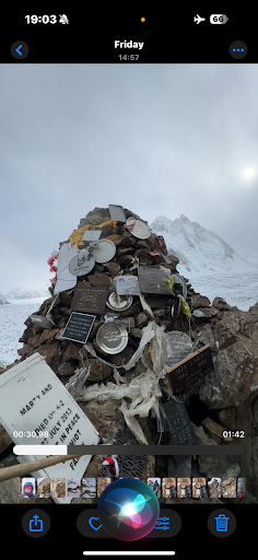
Along the way, we may visit the Gilkey Memorial, a place dedicated to climbers who lost their lives on K2.

As we approach base camp, the immense southern slopes of Gasherbrum rise above us, creating one of the most powerful mountain landscapes on Earth.

After enjoying the magnificent surroundings, we return to our designated campsite according to the expedition plan.

Climbing Period of Gasherbum I

Cleaning Up Basecamp: Preparation for descending back

Trek from basecamp to Concordia

  • Altitude: 4,512 meters
  • Trekking Time: 5–6 hours
  • Distance: 11.7KM
  • Today we undertake the most anticipated journey of the expedition: the trek to K2 Base Camp.
  • Following the Godwin-Austen Glacier, we continue towards the foot of the mighty K2, standing at 8,611 metres above sea level.
  • The route crosses a challenging landscape of glacial ice, rocky debris, and uneven moraines. Along the way, we enjoy exceptional views of the surrounding mountains, including Broad Peak and Chogolisa, also known as Bride Peak.
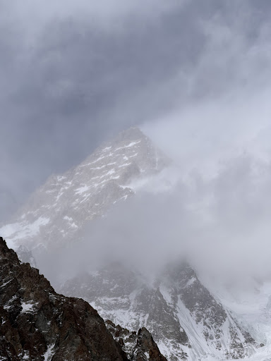
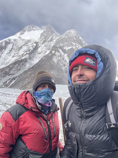
  • Chogolisa rises to approximately 7,665 metres and occupies an important place in mountaineering history. In 1957, the legendary Austrian climber Hermann Buhl lost his life on this mountain during an expedition with Kurt Diemberger.
  • As we approach K2 Base Camp, the scale of the mountain becomes increasingly overwhelming. Massive walls of rock and ice rise thousands of metres above the glacier.
  • K2 was first successfully climbed on 31 July 1954 by Italian mountaineers Achille Compagnoni and Lino Lacedelli.
  • Reaching K2 Base Camp is an extraordinary achievement and one of the most memorable experiences available to high-altitude trekkers.

  • Altitude: 5,000m
  • Trekking Time: 6–7 hours
  • Weather: Very cold, windy; snow and ice expected

Details:

We begin our journey towards Gondogoro La. The track leads southeast onto the Vigne Glacier. It’s a long hike across rough ice and snow. The campsite is basic and situated near a steep slope. Early meal and relaxation are essential as we prepare for our pre-dawn departure for crossing the pass.

  • Altitude: 5,585m (Pass), 4,600m (Khuspang)
  • Trekking Time: 8–10 hours
  • Weather: Very cold; wind chill, deep snow possible

Details:

A demanding but rewarding day! We begin before daybreak to safely scale the Gondogoro La. The trail is steep and has roped sections. At the summit, a spectacular 360° panorama shows K2, Gasherbrum I and II, Broad Peak, and Laila Peak. We then carefully descend to Khuspang. Crampons and harnesses are required.

  • Altitude: 4,150m
  • Trekking Time: 5–6 hours
  • Weather: Cold morning, pleasant day

Details:

Today’s walk is easier than the previous few days. The trek continues along the Gondogoro Glacier, offering vistas of spiky peaks and hanging glaciers. Dalsampa is a lovely, grassy campsite that offers views of Laila Peak. You will feel relieved as you descend into milder settings.

  • Altitude: 3,350m
  • Trekking Time: 6–7 hours
  • Weather: Warmer; dry air

Details:

We descend down into the lush Hushe Valley. The trail winds through trees and tiny farms, with Saicho marking the end of the glacier region. This is a popular camping with clean water and beautiful rock towers nearby.

  • Altitude: 2,300m
  • Trekking Time: 2–3 hours trek + 6–7 hours jeep drive
  • Weather: Warm to hot; potential dust storms

Details:

We hike to Hushe Village, the first proper settlement in days. After a short break, we board jeeps for a scenic return journey to Skardu. Check into your hotel, shower, and celebrate the successful crossing of Gondogoro La.

  • Altitude: 540m
  • Trekking Time: None
  • Weather: Hot and humid

Details:

Drop at Skardu Airport from where we will fly to Islamabad International Airport. Transfer to your hotel and enjoy a relaxed afternoon. Optionally, you can visit Lok Virsa Museum or shop at local markets.

  • Altitude: 540m
  • Trekking Time: None
  • Weather: Hot and humid

Details:

Another contingency day. If already in Islamabad, it’s a good time to explore the city’s rich heritage – Faisal Mosque, Pakistan Monument, or take a sunset view from Daman-e-Koh.

  • Altitude: 540m
  • Trekking Time: None
  • Weather: Hot and humid

Details:

Our services end after breakfast. You will be transferred to the airport for your onward journey. Depart with memories of a lifetime.

K2 Expedition Package Inclusions

K2 Adventure Guide’s full-service K2 expedition includes travel within Pakistan, porter support on the Baltoro approach, a private tent at K2 Base Camp, and one climbing Sherpa per member. Below is a breakdown of the services provided at each stage, from your arrival in Islamabad to your return from the mountain.

Expedition Services & Facilities

  • Domestic Flights: Return air tickets between Islamabad and Skardu.
  • Experienced Expedition Cook: Professional Pakistani cook accompanied by trained kitchen assistants.
  • Base Camp Accommodation: Comfortable sleeping arrangements at Base Camp, with a single-occupancy option available at an additional cost.
  • High-Altitude Porters (HAPs): One Pakistani High-Altitude Porter allocated for every two climbers.
  • Meals During the Expedition: Complete meal service, including breakfast, lunch and dinner, throughout the trek and at Base Camp.
  • Personal Baggage: A personal luggage allowance of up to 65 kg per climber.
  • Islamabad Hotel Stay: Four nights upon arrival and two nights after the expedition, including breakfast.
  • Communication Equipment: Walkie-talkie radios for communication and coordination throughout the expedition.
  • Base Camp Facilities: Dedicated dining tent, toilet facilities, shower arrangements and solar-powered charging points.
  • Expedition Load Carriage: Porter support for transporting food, camping equipment and other expedition supplies.
  • Weather Forecast Service: Regular meteorological updates and forecasts from European weather sources.
  • Emergency Support: Group emergency equipment and satellite telephone facilities, including fixed calling charges.
  • Electricity & Charging: Solar power systems and backup generators for lighting and charging personal electronic devices along the trekking route and at Base Camp.
  • Liaison Officer Expenses: Provision for the required equipment and allowances of the government-appointed Liaison Officer.
  • Staff Insurance: Insurance coverage for expedition guides, cooks, kitchen crew, assistants and porters.
  • Hot Water: Hot water facilities available at Base Camp.
  • Internet Connectivity: Complimentary Wi-Fi access at Base Camp, subject to local network availability.

K2 Expedition Package Exclusions

When planning your Broadpeak expedition, please budget for the following costs in addition to the package price.

Services & Expenses Not Included

  • Government Climbing Royalty: The applicable government royalty fee is excluded. As per the rates revised in September 2024, the summer-season royalty is USD 5,000 per climber, subject to any subsequent government revisions.
  • Supplementary Oxygen: Bottled oxygen and related equipment are not covered in the standard package.
  • Fixed Ropes & Climbing Hardware: High-altitude ropes and technical climbing equipment are not included.
  • High-Altitude Accommodation: Tents and sleeping arrangements above Base Camp are not provided under this package.
  • Food During the Summit Push: Meals, high-altitude food and snacks required above Base Camp must be arranged separately.
  • Group Climbing Equipment: Technical equipment such as expedition tents, ropes, ice screws, snow bars, gas cylinders, stoves and cooking utensils for use above Base Camp are not included in the standard Base Camp services.
  • Nepali Sherpa Support: Experienced Nepali Sherpas can be arranged upon request at an additional cost.
  • High-Altitude Climbing Leader: A professional climbing leader or Sherpa from Nepal can be provided upon request for an additional fee.

Maps

More from the Trail

Five 8000ers Base camp Trek-K2 Adventure Guide photo

What trekkers say about us

Zainab T.
1 year ago
I had a wonderful experience with their team. They were friendly, professional and went above and beyond in making my trip smooth and comfortable.
Tomasz
1 year ago
I've spent 3 weeks with K2 Adventure Guide in Charakusa on climbing trip. It was nice to be in Pakistan with them, beside couple of things that can be reconsider it was a good service and nice people 👍
Wojciech M.
1 year ago
I can only recommend K2 Adventure Guide agency. They organized our expedition to Charakusa valley. Transport from Skardu to Hushe and back, all equipment for the base camp, porters (be ready for tips) - everything was organized perfectly. We were staying in the base camp with Hussain and his helper - Ali and we really enjoyed their companion and the food they prepared. It is a small family business, but they can organize trips to really big mountains!
jing Z.
1 year ago
I am very happy to have had such a hiking experience in 2025, and I am extremely grateful to our K2 adventure guide company for making this trip possible and for helping us successfully cross the pass! Thank you to the strong logistics team! As a world-class classic hiking route, I hope more people will have the opportunity to hike K2!
Photo from customer reviewPhoto from customer reviewPhoto from customer reviewPhoto from customer reviewPhoto from customer reviewPhoto from customer reviewPhoto from customer reviewPhoto from customer reviewPhoto from customer review
alfa E.
2 years ago
Honest, local and good agency. I can higly recommend them for your adventure in Pakistan!
Mateusz
2 years ago
Very easy & fast organisation of necessary permits. In the meantime of waiting for permits k2 adventure will take care of you, and takes you to important and nice places around Skardu & Askoli. They are locals, so they know everything and everyone which makes the trekking much more enjoyable. They taking good care of the people by cooking good quality food on the way, and by providing safety at everytime. Definitely recommend these guys. PS - I was going to k2 base camp in WINTER! And they made it possible despite the fact that no one is walking there in winter. Harsh & difficult conditions. Amazing adventure with k2 adventure guaranteed
Photo from customer reviewPhoto from customer reviewPhoto from customer reviewPhoto from customer reviewPhoto from customer reviewPhoto from customer reviewPhoto from customer review
Szymon N.
2 years ago
K2 Adventure Guide is great agency! Create by people with passion and love to mountains. Hussain and his son Akhtar from Askole are super nice and helpful. They welcome us with hospitality, care and lot of smile. They hired the best team ever. Guides, cooks, helpers and porters. This amazing crew provide use unforgetable experiance of K2 Base Camp Summer Trek. With this experienced and commitment people we feel safe and comfortable, we have delicious food and lot of fun together. I fully recommend this Team.
Photo from customer reviewPhoto from customer reviewPhoto from customer review
Ivan I.
2 years ago
The trip to K2 was organized at a very good level. Base camp, kitchen, interaction with porters. I recommend👍
Iwona K.
2 years ago
Fairy Meadows & Nanga Parbat Base Camp Trek organised by K2 Adventure Guide was a fantastic experience. I got an excellent support from my guide and the tour organizer provided everything what was necessary during the trek. The accommodation was very good and I could enjoy tasty meals. K2 Adventure Guide, thank you - I will never forget that beautiful amazing trek.
Photo from customer reviewPhoto from customer reviewPhoto from customer reviewPhoto from customer reviewPhoto from customer reviewPhoto from customer reviewPhoto from customer reviewPhoto from customer reviewPhoto from customer review
santiago M.
2 years ago